Hiking trails in Sabah
Whenever Sabah is brought up, the iconic Mount Kinabalu and delicious bowls of sang nyuk mee come to mind. But if you have an adventurous streak, you’d also know that Sabah is blessed with a wealth of other mountains and hills with hiking trails that are waiting to be conquered.
Whether you’re looking to test your limits with a challenging climb or just yearn for fresh, mountain air with beautiful scenery, we’ve compiled a list of mountain hiking trails in Sabah, ranked from the easiest to climb to the toughest.
Also check out:
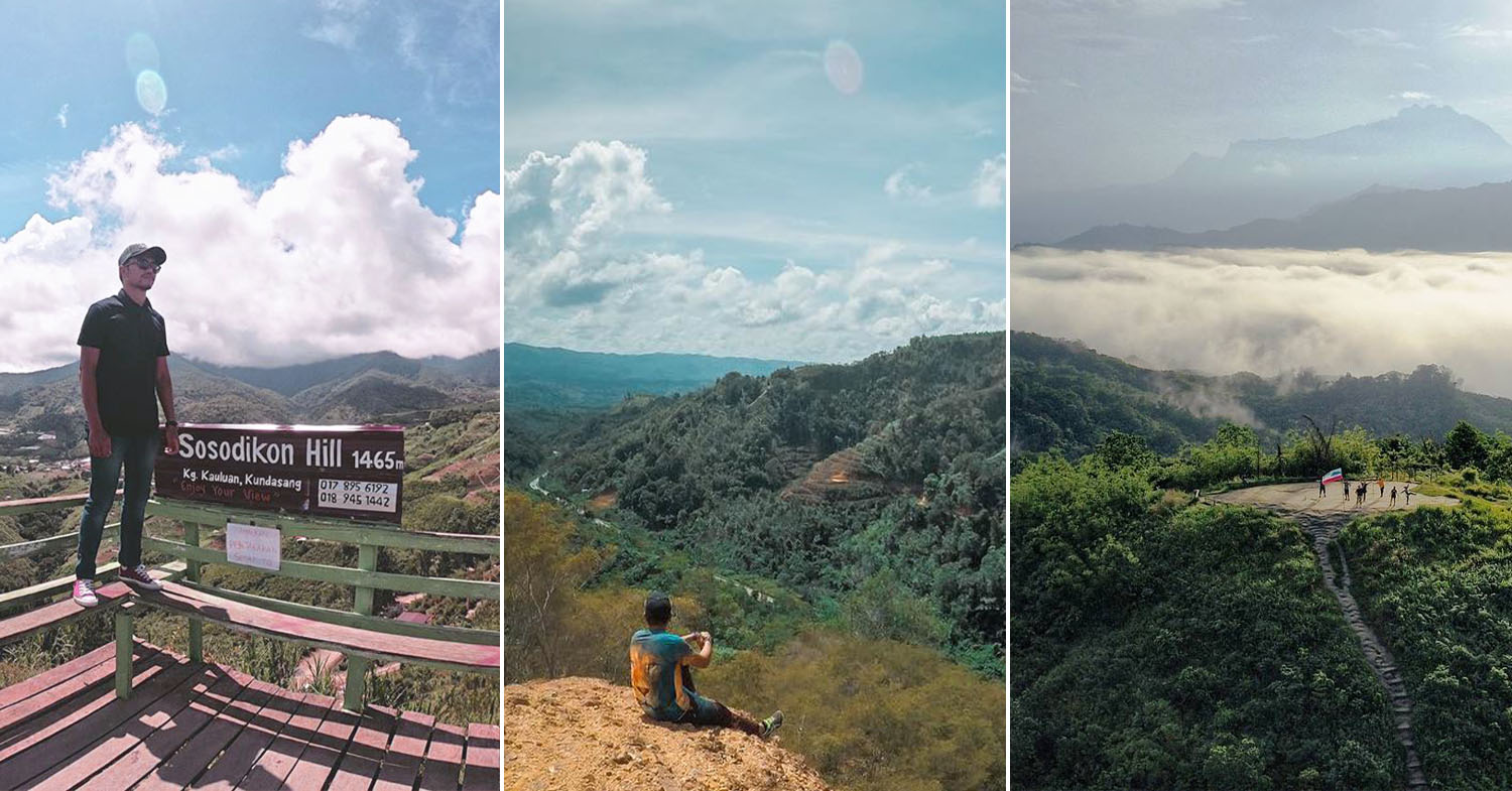
1. Sosodikon Hill – take in the view of “mini Switzerland”
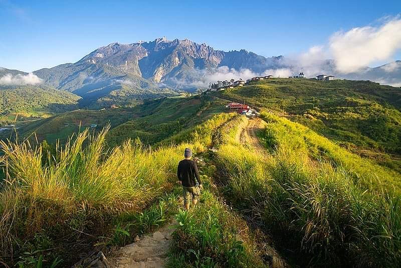
Image credit: @explorekundasang
Sosodikon Hill at Kundasang may just be a 20-30 minute trek, but the stunning view of the landscape that earned the town the title “mini Switzerland” warrants a visit here. Beyond the green pastures, you’ll see curving valleys and a stretch of mountains that is half-covered by mist.
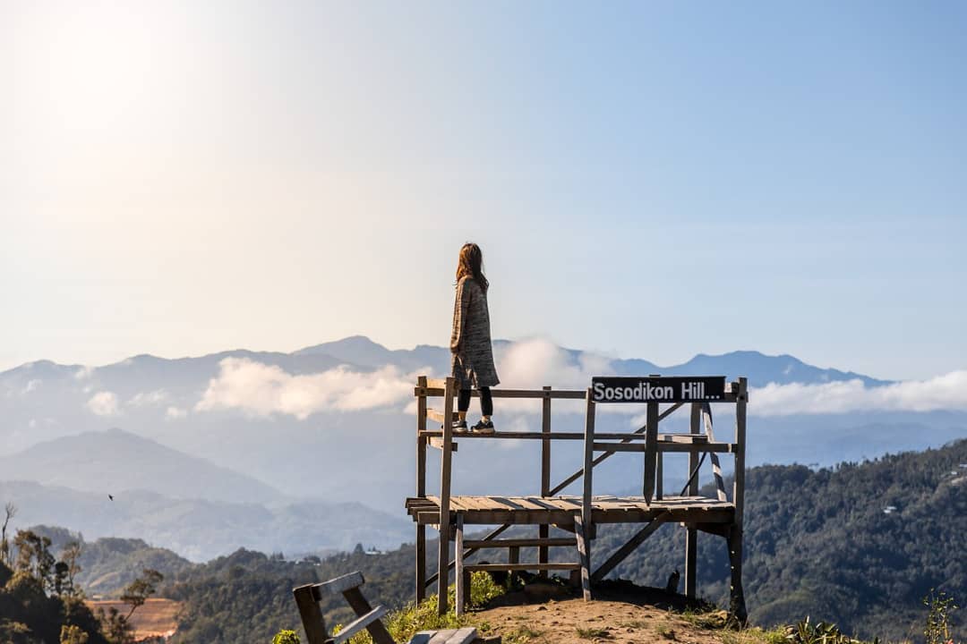
Image credit: @jeffffphoto
The easy and picturesque climb up can be done by anyone, regardless of age or fitness level, making it a perfect leisure stop for those visiting with their families.
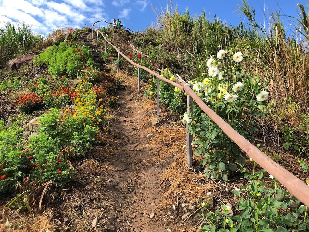
Image credit: @trouvaille_borneo
On your way up the hiking trail, you’ll be greeted by plenty of colourful flowers. With the fresh mountain air and cooling temperatures in the low-20°C, this might just be one of the most enjoyable “hikes” you’ll ever get to experience.
Fees: RM3/adult, free for kids
Address: Kampung Kauluan, Kundasang, Ranau Malaysia (Waze to Dream World Resort where Sosodikon Hill is next to.)
GPS coordinates: 6.0002° N, 116.5942° E
2. Matanoi Hill – take a photo in a giant “bird’s nest”
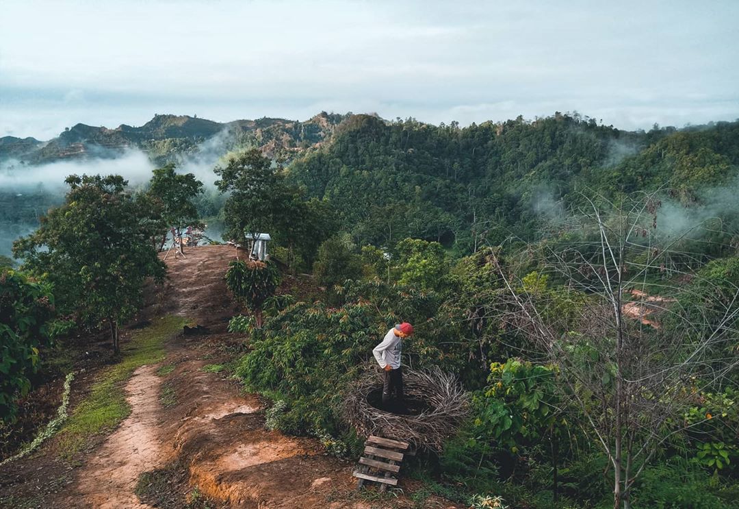
Image credit: @cfikmfag
Matanoi Hill is a popular tourist destination due to its short hike and the iconic giant “bird’s nest” at its peak. Climbing into the nest and taking a picture in it is almost mandatory, because, pics or it didn’t happen.
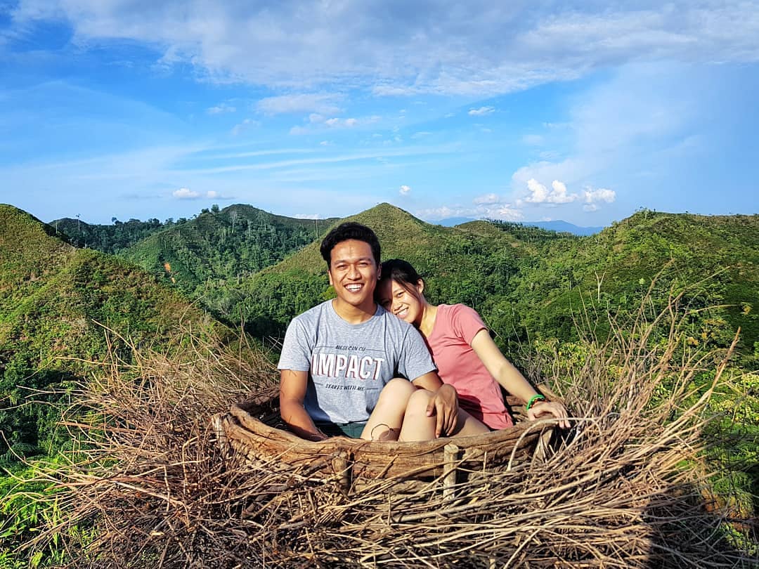
Matanoi Hill is one of many unique hiking trails in Sabah with its “bird’s nest” photo spot.
Image credit: @naveht
The end result is a stunning yet comical photo that is set against blue skies and lush, emerald hills. To get to this photo spot, you’ll need to tackle a brisk 20-30 minute hike to the top of the hill.
There are 3 trails to take, each with varying difficulty levels. No matter which one you opt for, they’ll all get you to your destination in about the same duration. For those looking to break a sweat, take Trail A that has a steep incline of almost 70 degrees. If you’re looking for an easy walk, go for Trails B and C instead.
Fees: RM3/adult and RM1/child
Address: Jalan Apin-Apin Bundu, Kg. Tiga, 89650 Keningau, Sabah
GPS coordinates: 5°29’34”N, 116°14’46”E
3. Bukit Janggut – fun photo spots scattered throughout the hill
Image credit: @fegyjs
Bukit Janggut is another easy hike for visitors who want to appreciate the lush nature that envelops Sabah without having to go through an arduous climb that’ll leave rookies heaving and panting.
Image credit: @traworld98
The 690m trail is well-maintained, so you won’t have to worry about slipping on rocky or slippery terrain. At steeper parts of the hill, there are makeshift bamboo handgrips to aid your hike while you feast your eyes on a seemingly endless stretch of field and valleys with scattered mountains in the background.
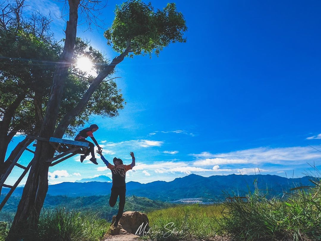
Image credit: @spermafiaplanet
While the views are serene, your hike will never get boring because of the various photo spots – including a wooden platform set on a tree and a white metal door frame – scattered along the climb up.
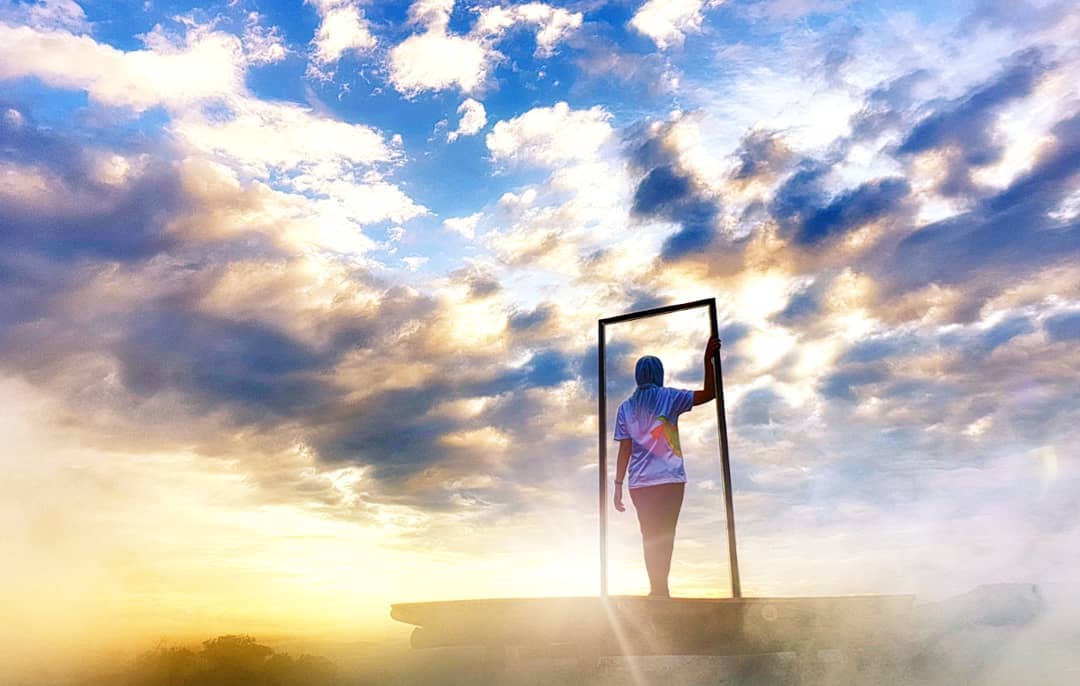
Image credit: @setia_sari
Address: Bukit Janggut, 89200 Kota Kinabalu, Sabah
GPS coordinates: 6.0759° N, 116.1595° E
4. Bukit Perahu – be surrounded by a sea of clouds
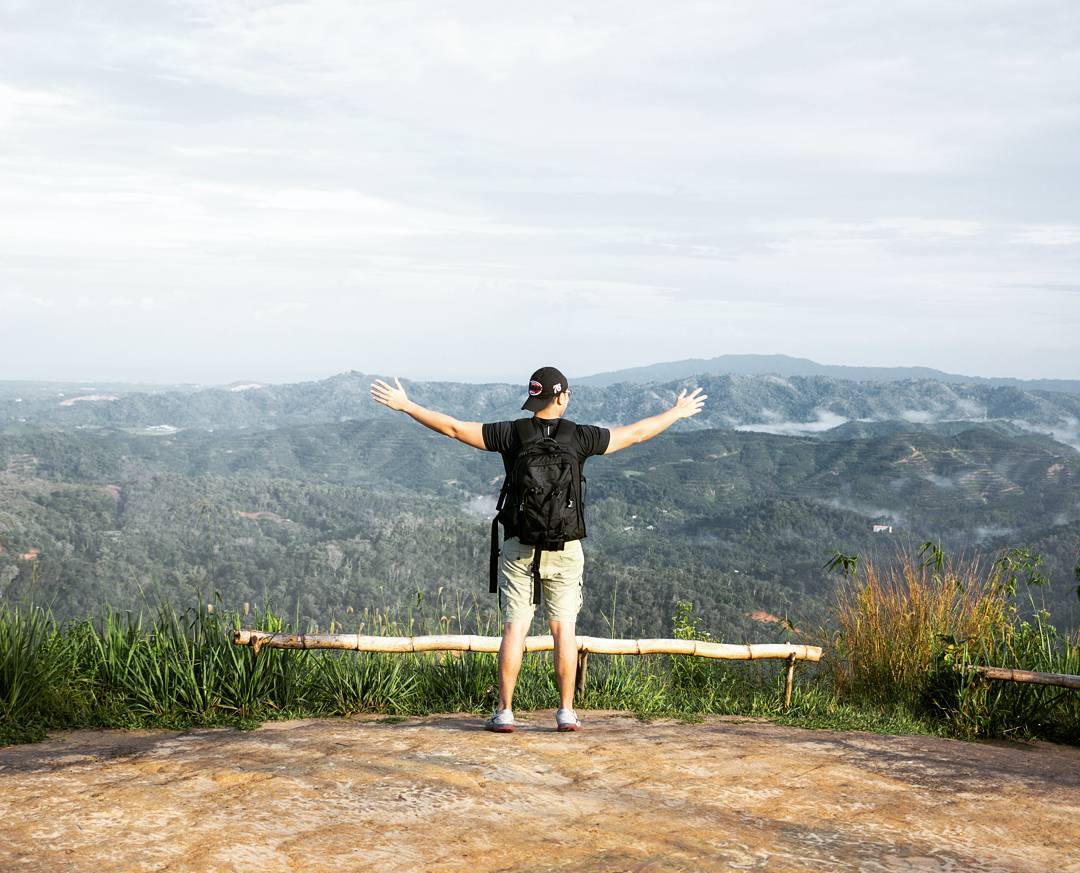
Image credit: @bryanchrislim
The promise of a stunning sight can motivate some of us to say yes to attempting a strenuous hike. If that sounds like you, then be sure to include Bukit Perahu or St. Veronica’s Hill in your list of to-climb spots as it’s said to have one of the most breathtaking views of misty mountains in Malaysia.
The hike to the top is 800m long, and some people have been able to conquer the climb in just 35 minutes. Regardless of your fitness level, it’s unlikely to take you more than an hour, which makes it a great spot for a brisk morning exercise.
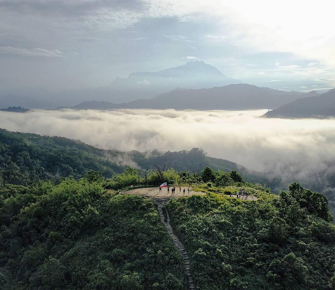
Hikers like to bring their drones along for this climb to capture the sea of clouds enveloping the landscape
Image credit: @bryanchrislim
It’s recommended to head here earlier in the day, when the morning breeze will help you fight off the heat from the sun. Trees along the trail also provide some shade for hikers.
Tamparuli, the town where Bukit Perahu is located, is just a 30-minute drive from Kota Kinabalu’s city centre, so you can easily squeeze this spot into your itinerary.
Address: Jalan Tamparuli Togop, 89250 Tamparuli, Sabah
GPS coordinates: 6.1355° N, 116.2789° E
5. Bukit Botak – a scenic field of wild grass
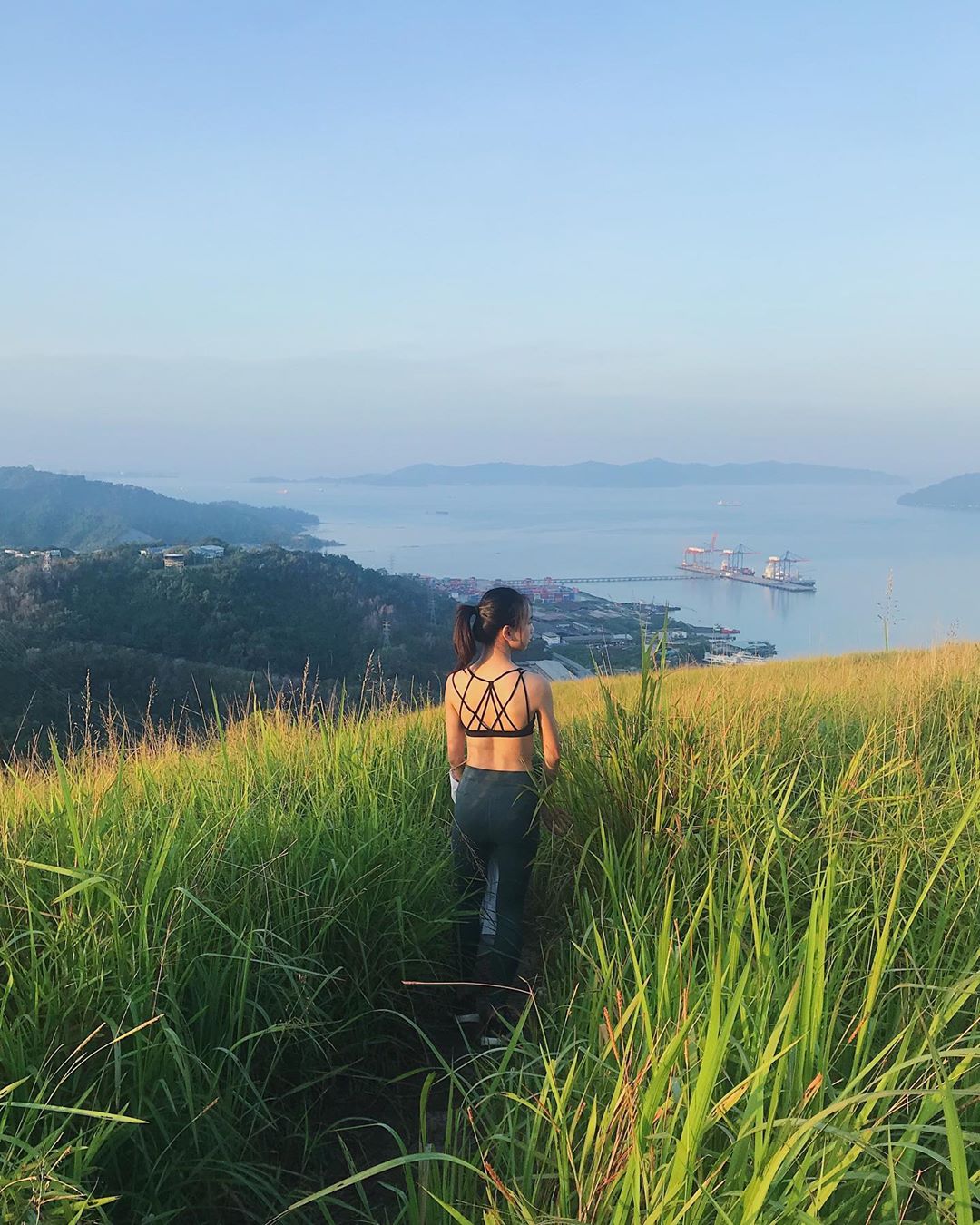
Image credit: @michmaj
Hikers who are looking to break a sweat can consider Bukit Botak, where there are 2 trails for you to choose from. The first trail will take you to the top in about 35 minutes. It’s on an incline of 40 degrees, so it’ll definitely be a test of endurance as you power through.
The second trail is the longer of the two, and will require you to hike over 2 hills. There are beautiful nature sights to take in while you make the hour-long trek up. The variations in the terrain also makes the journey an interesting one – there’s a segment that will need you to get down on your knees to crawl through some bushes.
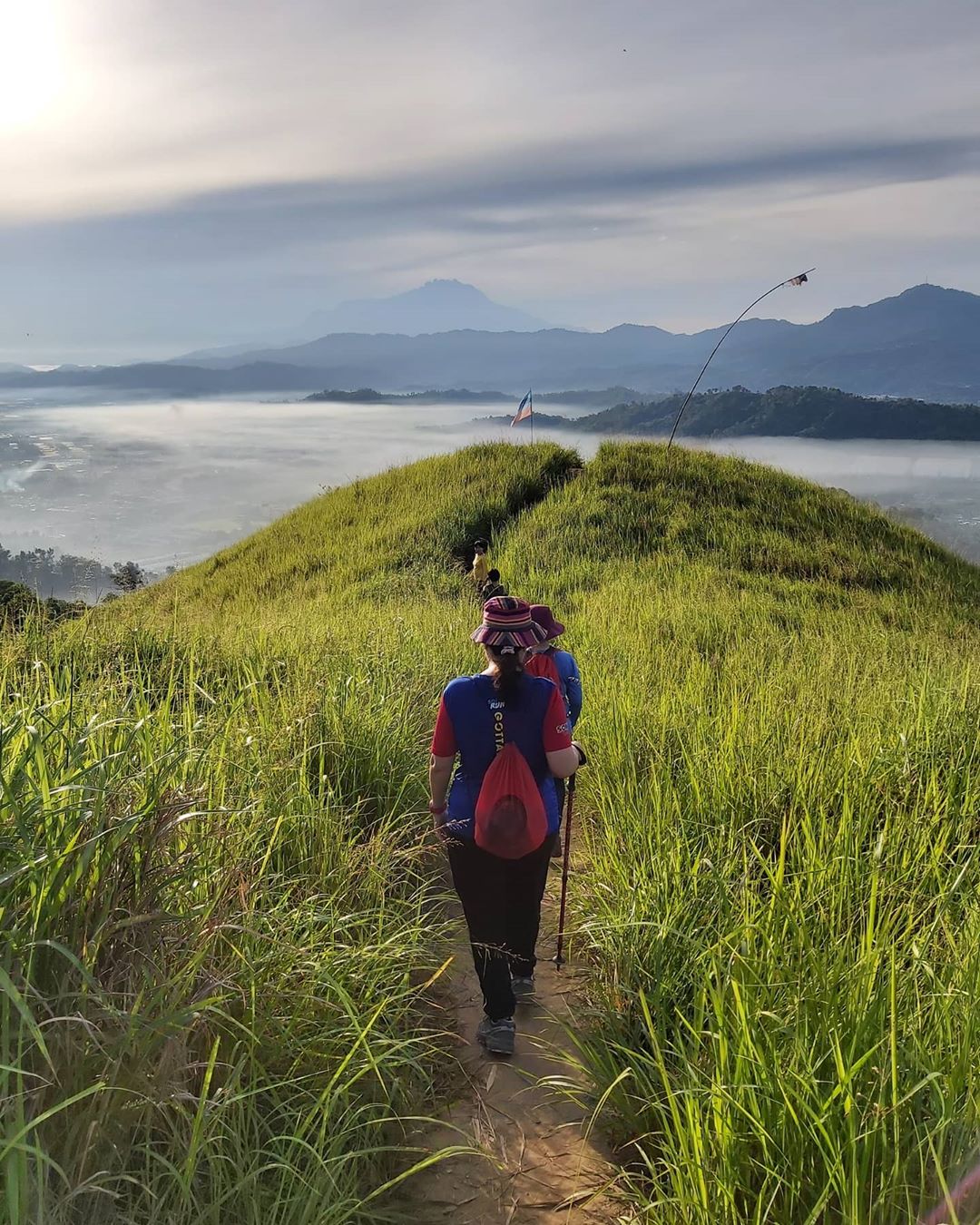
Image credit: @follow_janice
Don’t be fooled by the name as the hill is not at all botak or bald. You’ll pass by a forest during your hike up, but once you’re at the top, you’ll only be able to see a field of wild grass and bushes without a tree in sight.

Image credit: @borneo3sixty
When the wind blows, you’ll get the chance to behold the sight of the wild grass swaying gently from side to side – a great photo opportunity for you to commemorate your hike.
Address: Sabah Port Bypass, 89200 Kota Kinabalu, Sabah (starting point)
GPS coordinates: 6.0796° N, 116.1383° E
6. Bukit Kopungit – for views of the sea and mountains beyond
Image credit: @melissasulaiman
Bukit Kopungit in Kota Kinabalu is considered an iconic mountain hiking trail among locals and visitors, as you’ll be able to see bunker tunnels built during World War 2 during your climb up.
Image credit: @mem_umie
Amateur hikers will also be able to conquer this 2km trail, though there are steep climbs that may require you to get on fours for maximum stability. Once you reach the top, you’ll be granted a panoramic and breathtaking view of the city that extends to the ocean and mountains beyond.
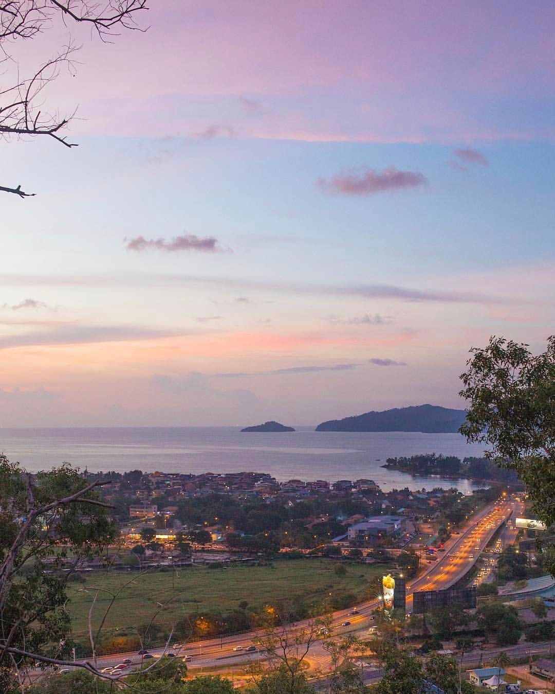
Image credit: @anwaric
Bukit Kopungit is one of the most accessible hiking trails in Kota Kinabalu, Sabah as it’s only a short 10-minute drive from the airport. To get there, simply search “Bukit Kopungit hiking trail” on Waze.
GPS coordinates: 5.9469° N, 116.0659° E
7. Bukit Lugas – a narrow ridge that overlooks a plantation
Bukit Lugas in Tambunan only became a popular destination among climbers in recent years when photos of the hill’s “dragon spine” started making its rounds on social media. It didn’t take long before excited and adventurous Malaysians started flocking here.
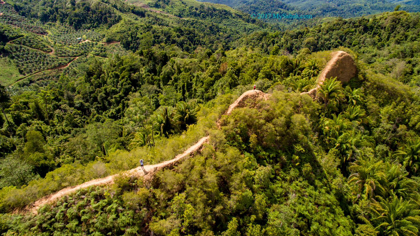
Image credit: MySabah
From afar, one can see the “twin hump” that looks as if they could be a dragon’s back. The narrow path makes this climb suitable only for those with iron hearts as this trail is certainly out of the question for those with acrophobia.
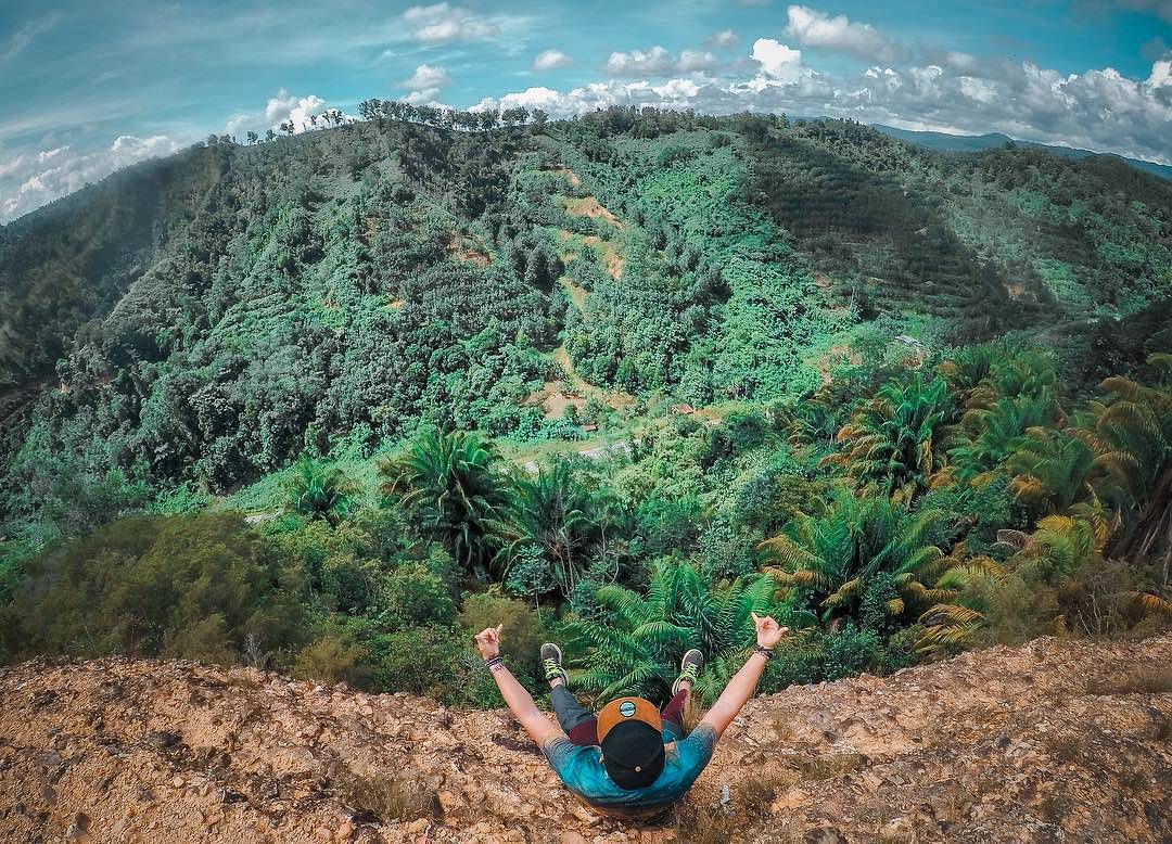
Image credit: @borneorimbawan
The climb to get to the ridge is said to be a relatively easy one as there are no particularly steep climbs and you’ll just be walking most of the way. However, Bukit Lugas is still considered a challenging trail, at 1.7km long, and will take you about 4 hours to conquer a round trip.
As Bukit Lugas is not situated at a park, hikers can only trek up with a guide. You can find a list of guides provided by MySabah here, and it’s best to contact one before making the 2-hour drive from Kota Kinabalu to Tambunan, where the hill is.
Fees: Guide fee of RM30/group (up to 10 pax)
Address: Bukit Lugas, 220, Jalan Keningau – Tambunan, 89650 Tambunan, Sabah
GPS coordinates: 5.5138° N, 116.2754° E
8. Mount Alab – journey through the middle of a rainforest
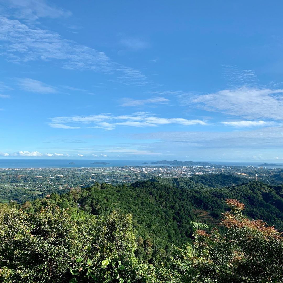
The view from Mount Alab
Image credit: @foomankk
Climbing Mount Alab is no easy feat, as the 9-hour hike is usually reserved for seasoned hikers. Day trips are common, but some hikers opt to go for a 2D1N climb so they can get a little rest.
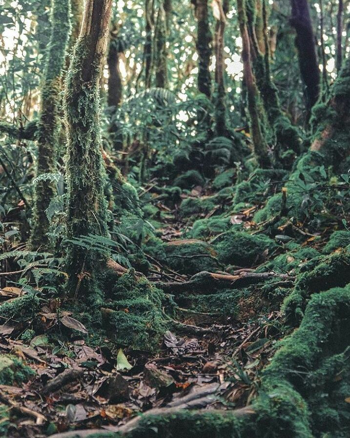
Image credit: @borneorimbawan
The 12km trail takes you through the dense jungle where the track is covered by fallen leaves and moss. Overarching branches from the tall, tropical trees envelop the area and cover up almost half of the sky.
Because you’ll be right smack in the middle of a rainforest, you can expect fluctuations in weather and temperature as it can go from sunny (21°C) to a downpour (11°C) suddenly.
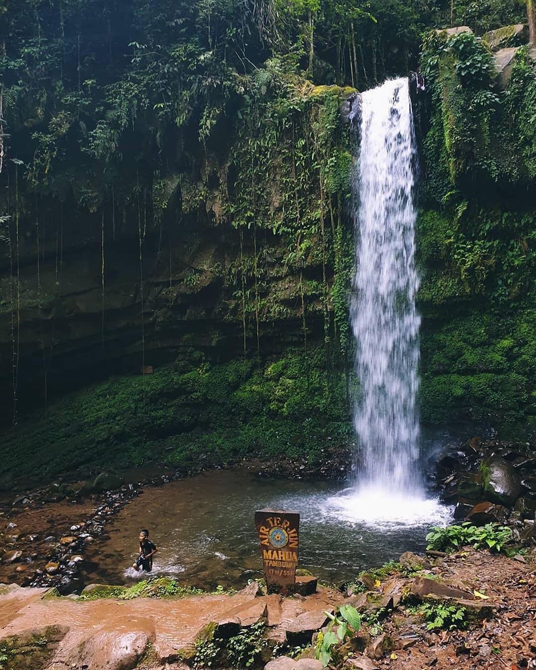
No hike to Mount Alab is complete without a dip in Mahua Waterfall
Image credit: @adznorjunaidi
As it’s not an easy hike, it’s always recommended for visitors to book a tour package so that you’ll have an experienced guide around.
The most affordable tour packages are priced at around RM400-500 for a day trip, and you can check them out at Amazing Borneo and Klook. Depending on your package, transportation will be provided directly to and from your hotel in Kota Kinabalu so that you don’t have to make the 30km journey to the foot of Mount Alab yourself.
GPS coordinates: 5°49′47″N 116°20′30″E
9. Mount Kinabalu – stunning granite summit
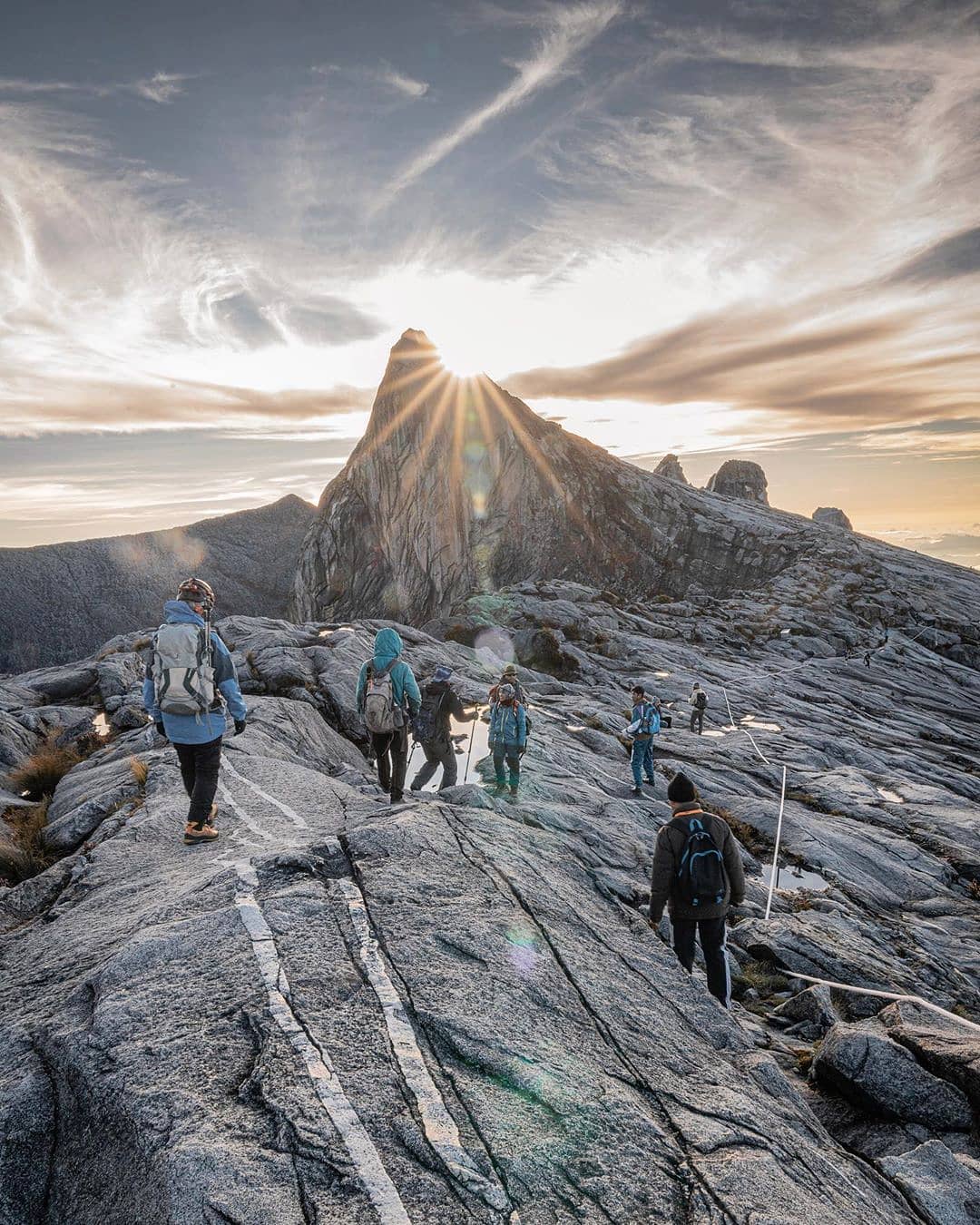
Mount Kinabalu is one of the most popular hiking trails in Sabah
Image credit: @floravitro
At a staggering 4,095m tall, Mount Kinabalu is the tallest mountain in our country and has a spot in almost every Malaysian’s bucket list. After all, we’ve heard plenty about its stunning granite peaks and the wispy clouds surrounding the dream-like landscape.
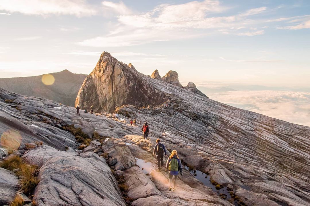
Image credit: @stijinrietbroek
However, getting to the top is no easy feat as there are plenty of hurdles that you’ll have to overcome first. For one, you’ll have to cross a suspension bridge made of thin wooden planks that overlooks the rocky edges of the mountain.
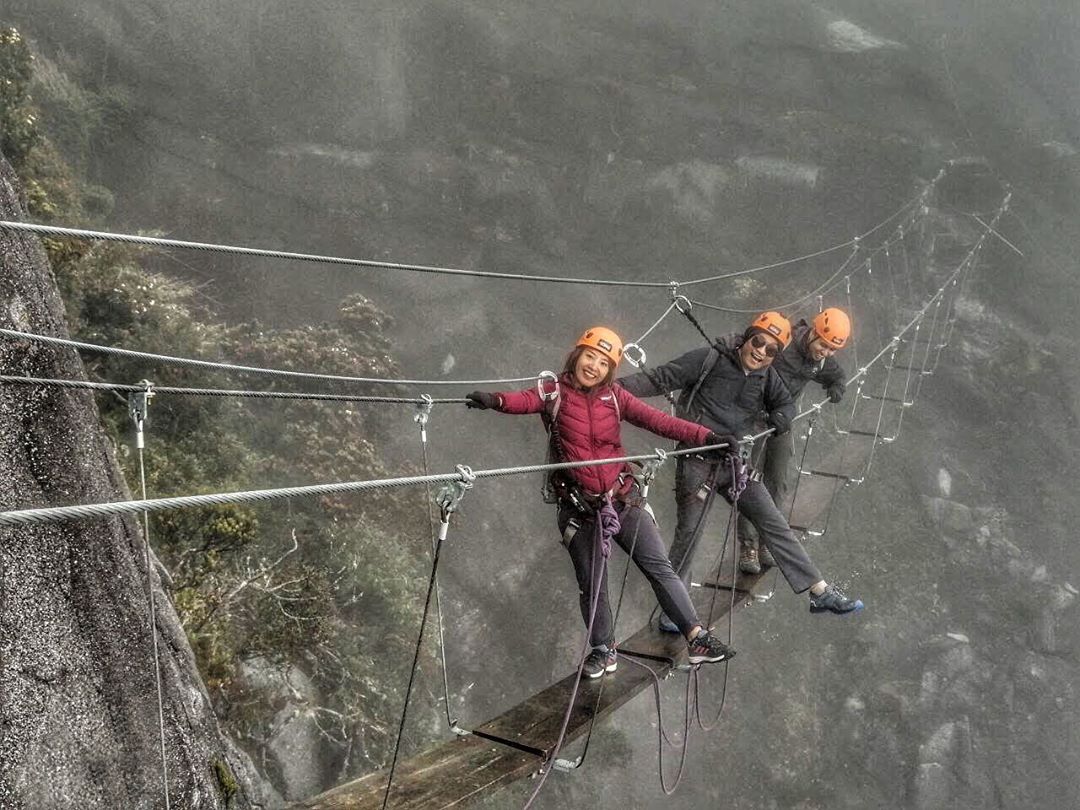
Harnesses are provided to ensure safety
Image credit: @aleemawashif
And once you’ve journeyed through the tropical forest at the bottom half of the mountain, you’ll reach a rocky, granite plateau where it’ll get steeper and steeper. At this point, you’ll be climbing at an almost-90 degree incline with the help of metal footholds fixed into the side of the mountain.
The large puddles at the peak reflect the clear sky above, making it an Insta-worthy spot for pictures.
Image credit: @embun_is_here
To climb Mount Kinabalu, you’ll need to hire a professional guide. MountKinabalu.com has affordable all-inclusive 2D1N packages starting from RM1,880/pax, depending on your climb date. They also have options for 3D1N journeys with varying price points to cater to different budgets.
GPS coordinates: 6.0753° N, 116.5588° E
10. Mount Trusmadi – an extreme climb that takes 4 days
Image credit: @padlirrr
If you’ve managed to conquer Mount Kinabalu, consider booking a second trip to Sabah to take on Mount Trusmadi next. It is the 2nd-highest mountain in Malaysia at 2,642 metres above sea level, but avid mountaineers will appreciate the intensity and difficulty of the trails here.
In fact, many have even claimed that Mount Trusmadi is a much tougher climb than Mount Kinabalu.
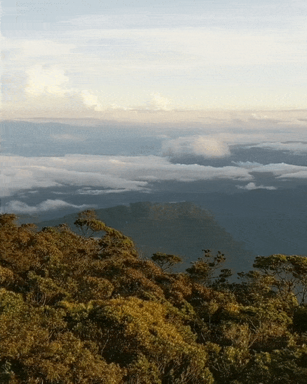
At over 2,6000 metres above sea-level, you’ll be looking at clouds below instead of above you.
Image credit: @thili28
There are three trails that you can take to get to the peak. The Wayaan Kaingaran (4.9km) and Wayaan Mastan (4.3km) trails require an overnight stay, while the third and longest trail, Wayaan Mannan (11.3km), will have you camping there for 4 days. Most hikers tend to go for the first 2 mentioned, while the hardcore hikers will want to take on the longest trail.
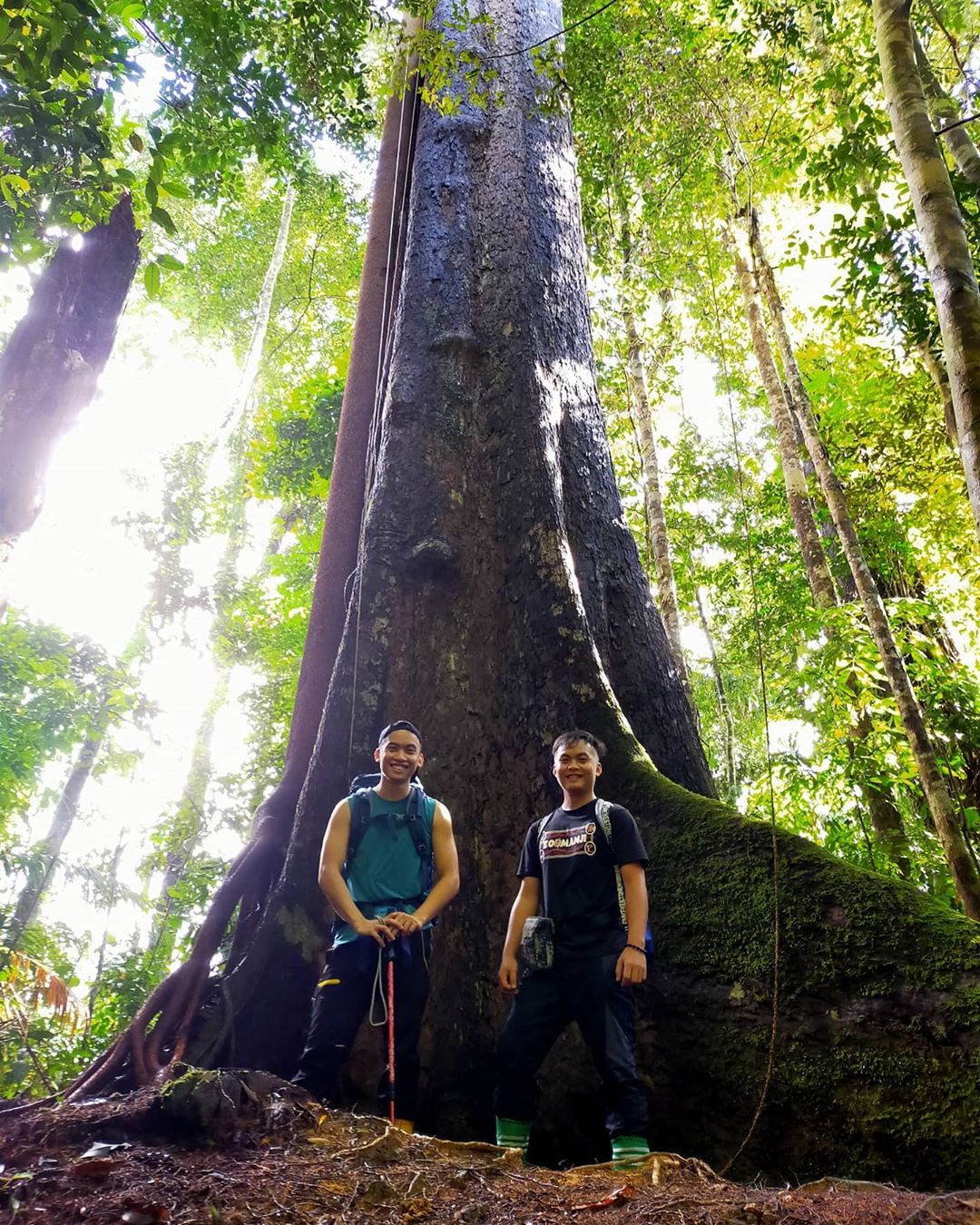
Giant trees like this one aren’t rare sightings in Mount Alab
Image credit: @cafassopaso
If you’re keen to take on the challenge, be prepared to climb vertical rock faces that require you to pull your weight up using the ropes provided, often without a harness. There are certain parts that require you to use the ladders too. There are also narrow trails with steep drops on both sides that you have to carefully navigate through.
The average price point for a 2D1N tour package is RM1,300 while you can expect a heftier sum for 4D3N packages that are usually over RM2,000. You can consider getting your packages from Amazing Borneo or River Junkie.
GPS coordinates: 5.5500° N, 116.5167° E
Scenic hiking trails in Sabah, Malaysia
Malaysia has long been considered a paradise by tourists for our abundance of stunning beaches and equally scenic mountains that are often engulfed in lush, tropical rainforests. With Sabah’s largely untouched landscape, the state has some of the best and most unique mountain hiking trails that Malaysia has to offer.
Check out other outdoor activities to do in Malaysia:
Cover image adapted from: @paez_wings, @bryanchrislim and @borneorimbawan